
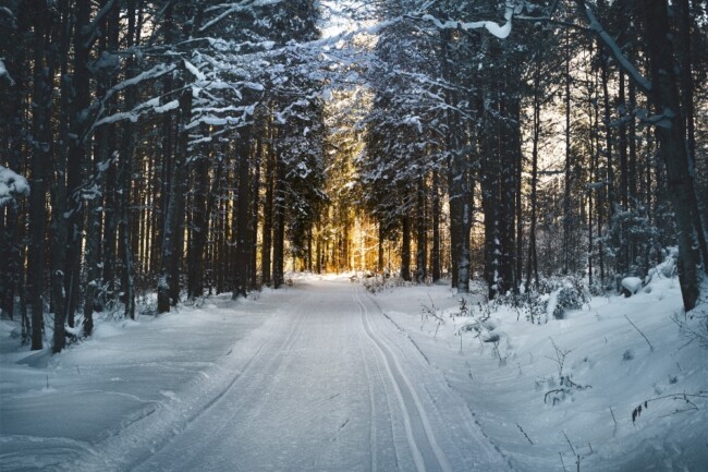
Just because it’s winter doesn’t mean you can’t enjoy a hike through our nearby wilds. Plus, the weather has been pretty mild, so you might as well get out and enjoy it before the inevitable snow hits. If you’re taking advantage of the great outdoors, we’ve rounded up some great hikes for winter in the New York + New Jersey area so you can bundle up and hit the trails. Read on for five great hikes for winter in the NY/NJ area.
Hubbard Lodge Loop Trail
Located in Clarence Fahnestock Memorial State Park, this hike is near the cute town of Cold Spring, NY (which is also an excellent spot for a post-hike hot chocolate). Parking is at the Hubbard Lodge trailhead, where you can start two separate trails — which are flat, easy to follow, and run alongside a stream for much of the walk. There are also opportunities for full-day hikes if you follow School Mountain Road to the Wiccopee trail.
Hike Notes:
- Map: NYNJ Trail Conference Map 103 — East Hudson Trails
- Start: Hubbard Lodge just north of Route 9/Route 301 intersection
- Short Loop: White + Yellow blaze trails, 2 miles
- Medium Loop: White + Yellow + Red blaze trails, 5.15 miles, and includes a ruin
Read More: Hiking Trails to Try Out in Orange County, NY
Manaticut Point Loop Trail
This loop trail is located in Norvin Green State Forest and passes by the beautiful Lake Sonoma. There are also lovely views from Overlook Rock. This trail covers a variety of hilly terrain with a total distance approximating four miles. Park on Crescent Drive at the trailhead.


Hike Notes:
- Map: NYNJ Trail Conference Map 115 — North Jersey Trails
- Start: On the Yellow/Black trail and follow the yellow trail loop counterclockwise, 4 miles
Windbeam Mountain Trail
The Windbeam Mountain trail is located in the North Jersey District Water Supply Commission. This hike features a single 700-foot climb to the mountain’s peak, where you’ll find a flagpole at the trail’s end. It’s a hike in and back of about 2.5 miles. We recommend micro spikes if the route is slippery. There’s easy parking at the Stonetown Recreation Area parking lot.

Hike Notes:
- Map: NYNJ Trail Conference Map 115 — North Jersey Trails
- Start: Cross Stonetown Road and walk south just past the last house until you find the start of the red trail. Follow the red trail all the way up to the peak of Windbeam Mountain. You’ll know you’ve reached the top when you find the flagpole. Come back the way you came. Total distance is approximately 2.5 miles.
- Hike Options: Opportunity to extend the hike significantly by following the Stonetown Circular red trail all the way around to hit Board Mountain, Harrison Mountain, Tory Rocks, and Signal Rock. Full day required for the longer hike (10.8 miles), with 2,545 feet of elevation gain.
Monksville Reservoir Loop Trail
The Monksville Reservoir is a lesser-known hike, approximately eight miles. It has a climb up to the ridge with views of the reservoir below. Park at South Boat Launch just north of the Monksville Dam.
Hike Notes:
- Map: NYNJ Trail Conference Map 115 — North Jersey Trails
- Trail Instructions: Follow the white trail past Winston Mine. Cross Greenwood Lake Turnpike, pick up the Green trail on the other side going north. Once you arrive at a T-junction with the Yellow Hasenclever Iron trail, turn left. Follow the Yellow trail until you cross the suspension bridge across the Wanaque River to the Long Pond Iron furnaces. Link up with the Sterling Ridge Highlands Trail (teal blaze) heading south. Cross Marshall Hill Road Turnpike and continue south on the Highlands Trail. Follow the Highlands Trail to Horse Pond Mountain and then Harrison Mountain. At Harrison mountain, it links up with the red trail. Follow the Highland Trail and red trail northwest back towards Monksville Dam. Once you reach Stonetown Road, it is a 3/4 mile road walk over the dam and back to the car. Total distance is approximately 8 miles.
See More: Where to Go Hiking in the Montclair Area
Sterling Lake Loop Trail
The Sterling Lake Trail features some exciting ruins from the early days of metal foraging. If you like exploring these abandoned sites in the woods, then this is a hike for you. Park at the small lot just off Old Forge Road.
Hike Notes:
- Map: NYNJ Trail Conference Map 100 — Sterling Forest Trails
- Trail Instructions: Walk to Old Forge Road and turn right. Walk a few hundred feet until you reach another residential road heading NNW. Find the Blue Trail, which crosses the road. Follow the Blue Trail counterclockwise (head east and then north initially) all the way around Sterling Lake. Once you have completed the circuit around the lake, you will reach the Ore Processing Ruins. Take some time to explore. Continue on the Blue trail back to the intersection where you first joined the trail. A short walk from the road back to your car. Total distance is approximately 4.2 miles, with 449 feet of elevation gain.
Kaaterskill Falls Trails
Kaaterskill Falls is a two-stage waterfall on Spruce Creek in the eastern Catskill Mountains of New York in Greene County. This hike is stunning when it snows. There are three places you can park here: Laurel House Road parking area, Scutt Road parking area, and South Lake parking lot (North South Lake Campground).
- Map: NYNJ Trail Conference Map 141 — Catskill (Northeastern)
- Instructions from the Laurel-House Road parking area: It’s 0.3 miles to the observation platform overlooking Kaaterskill Falls. This firm gravel trail has minimal elevation change with a typical grade of 7%, and provides outstanding views of the falls and valley below. A 0.7-mile hike from the parking area leads from the gravel trail to a more naturalized section of trail, descending a moderately steep slope down to the lower pools at the base of the falls.
- Instructions from the Scutt Road parking area: Follow the blue-marked Escarpment trail south. At 0.5 miles, continue on the blue-marked trail. Crossing the Spruce Brook bridge leads to the viewing platform, continuing along the Escarpment trail leads to the junction with the yellow-marked Lower Falls trail.
- Instructions From the South Lake parking lot: Walk south along South Lake Road for approximately 200 meters to the yellow-marked South-Lake access road on the right. Follow this trail to the next trail junction, and continue on the blue-marked Escarpment trail toward the Spruce Creek bridge or the Lower Falls trail.