

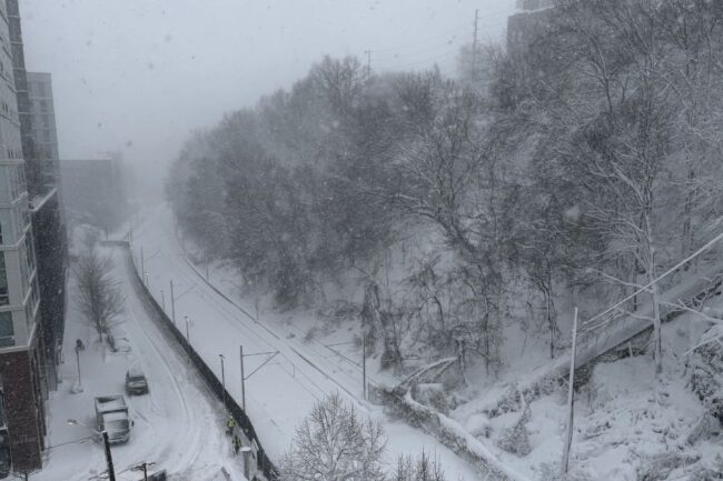
The blizzard of 2026 has already brought multiple inches of snow, transit suspension, and fierce winds — but forecasters say the storm isn’t done yet. As of this morning, the blizzard is now officially a “bomb cyclone,” a designation given to “rapidly intensifying nor’easters,” according to NJ News 12. Known formally as bombogenesis, this happens when a cyclone rapidly intensifies, or strengthens, over 24 hours. News 12 reports that all of New Jersey’s worst blizzards have undergone bombogenesis.
As the storm rages on, we’re answering a few key questions and need-to-knows below. Stay safe out there, New Jersey!
When is the snow supposed to stop?
Per the National Weather Service, NJ locals can expect to see snow until around 1PM. “The snow could be heavy at times. Areas of blowing snow before 4pm. High near 34. Wind chill values between 15 and 20. Windy, with a north wind 22 to 30 mph, with gusts as high as 46 mph. Chance of precipitation is 100%. Total daytime snow accumulation of 4 to 8 inches possible.”
The National Weather Service’s Blizzard Warning will remain in effect until 6PM tonight, with up to an additional 10 inches of snow possible, according to a Nixle alert from the City of Hoboken.
The NWS also forecasts more snow this week, with light accumulation on Tuesday and Wednesday. You can read the full NWS forecast here.


Is there still a travel ban?
On February 22nd, NJ Governor Mikie Sherrill announced that New Jersey would be under a travel ban starting at 9PM and ending at 7AM the following day. The travel ban has now been extended until 4PM on February 23rd, as snow conditions continue to worsen.
Are trains and buses running?
As of 7AM on February 23rd, NJ Transit Train, Bus, Light Rail and Access Link service is suspended. All services will remain suspended until conditions allow for a safe, gradual resumption. See the latest updates here.

What about PATH trains and ferries?
PATH: As of 7:39AM, NWK-JSQ, HOB-WTC PATH lines are suspended; JSQ-WTC, JSQ-33 via HOB lines are operating with delays; and HOB-33 line is operating on or close to a 20-minute schedule.
NYW: Per New York Waterway, ferry service from Hoboken/NJT to Brookfield has a delayed opening but will be running starting at 7:40AM, and Port Imperial & Hoboken 14 service to Brookfield Place and Pier 11 is operating on a modified schedule. All other listed routes are cancelled for the day.
Statewide Emergency Resources
As winds increase and conditions worsen, power outages are extremely possible. Here are a few state-wide resources to know about.
Life-Threatening Emergencies
Call 911 for police, fire, or medical emergencies.
Cold Weather Shelter + Immediate Help (Statewide)
- NJ 211 – Code Blue + Warming Centers (Live List)
- Updated in real time when counties activate Code Blue
- Includes shelter locations, hours, and transportation guidance
Statewide Emergency + Storm Alerts
- New Jersey Office of Emergency Management (ReadyNJ)
- NJOEM Weather, Traffic + Emergency Hub
- NJOEM – Staying Informed / Alert Channels
We also have lists of resources for specific New Jersey regions. Click the links below to see yours.
- Hudson County snow resources
- Montclair/Essex County snow resources
- Bergen County resources
- Jersey Shore resources